08:30 Ding up, anchor up, we're goin' fishin' on this beautiful morning.
08:55 Off Yule Rock in 120 feet of water and clear of the humps and bumps near the anchorage so we drop in our gear. A big bull Sea Lion watches us as we idle our way past the largest of the O'Leary Islets. He's all by himself basking in the sun. Wonder where his harem is?
09:10 Double Header! I have to let mine fight the pole in the holder while I net Lois' fish, then she nets mine. Her's is a nice little Coho. She was at about 35 feet down with a green flasher and a green hoochie. Mine is a Chinook not much bigger. I was at 100 feet with a green flasher and a pink hoochie. The fish couldn't have been in the same school even though they both hit at the same time. Must have both been working the same feed mass.
09:40 No more action from the salmon and the chart shows we're in 30 fathoms on a sand bottom so we decide to see if there's a halibut down there. Lois jigged, I decided to take a chance on catching dogfish and put a squid on a hook. Got not a bite on either. Halibut just doesn't seem to be our bag.
10:15 On to new adventures. Wound our way past the many rocks and reefs of Battle Bay and up the channel toward Ououkinsh Inlet. Turned right into Gay Passage and found our way into Scow Bay. Weatherman is predicting a front coming through with winds from the southeast so Scow looks like the best hidy-hole around. It also looks like a good base from which to explore the Bunsby Islands.
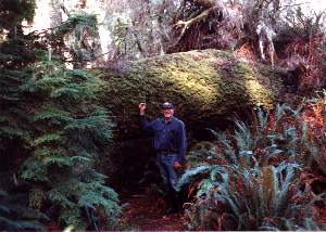
12:00 Anchor firmly set in what's probably a mud bottom, ding down, lunch eaten, ready to go. Ran out of our bay, across Gay Passage, and around the end of the largest of the Bunsbys to Checkaklis Island to the west. Checkaklis is an Indian reservation island and one that Phil and Mary had told us was a "must see". We weren't disappointed. In a little bay formed by Checkaklis and the most westerly of the Bunsbys is a beautiful white sand beach below a high rock cliff. We landed there and followed a trail which led to natural steps up the side of the rock. Climbing those, using tree branches and roots as handholds, we came out on the grass covered flat top of the rock about 150 feet above the sea. Three or four acres in area, this must have been the site of the village. And what a view! Ours in Friday Harbor is spectacular but this beats it hands down! We looked out over the sea and the rocks, reefs, and islands which we've been picking our way through toward the high mountains of the Brooks Peninsula. In the foreground a grass topped pinnacle rock almost as high as the one we were on stands over the waves breaking on the rocky shore below. What a place to see friend or enemy approaching. I was kicking myself for not bringing the camera. We poked around up there for an hour. Lots of sign of recent visitors and campers but no sign of anything old except the deep shell and ash midden. On the south side of the rock a sheer cliff drops off into a chasm reminiscent of the Devil's Punchbowl on the Oregon coast.
Leaving this spectacular retreat, we motored on around the northwest side of the islands to an unnamed bay north of Gay Passage where we'd been told there was a trapping ans trading station. Not a whole lot to see there. An abandoned log cabin and orchard grown over by the forest. The log cabin was very well built and still stands straight in spite of extensive decay, but the floor and roof are almost gone. Lois picked up a bunch of "treasures" on the beach - bits of broken dishes, light fixtures, and rocks. First sign of oysters - a few shells lying on the shore, but we couldn't find any alive.
In the late afternoon the clouds and wind that the weatherman has been predicting arrived. He's predicting several waves coming through. Hope our summer hasn't ended. Baked Lois' little salmon for dinner. It would have made a meal for four but it turned out so good we pigged out and ate the whole thing.
10:35 Past the turn point at Cole Rock and running up wind and down wave toward Kyuquot we start seeing Sea Otters. They seem to be everywhere, either lying on their backs with head and tail above water or rising straight up, head held high, to watch us go by. Cute little devils.
11:00 Tied to the government float in Kyuquot after navigating the winding entry channel. That was a snap though; it's marked all the way in with buoys. You'd have to really be asleep to go wrong. They made an announcment on the radio that commercial fishing had been closed down and I had expected the floats to be filled with fishing boats, but there was only one on the long dock. Kyuquot is pretty quiet right now. We found that the restaurant is closed for the season and the store doesn't open until 1:00, so we spent the next couple of hours writing letters and printing out this log. When it opened the store was pretty well stocked. They get their supplies in on Thursday each week so we are here on the right day. We bought fresh fruit and vegetables, milk, and other goodies which were getting low. Posted our mail at the Post Office which is also in the store. Nice young couple run the place. Very friendly and helpful. There's a phone right on the wharf and we were able to get calls through to Dad, Jean, and Nan. Told Nan we'd meet she and John in either Fair Harbour or Zeballos next Saturday or Sunday.
In the late afternoon the storm which the weather people have been predicting finally hit. Started out with a gentle rain but soon became a torrent. And lots of wind. We decided to just hang in here on the dock. Had pork chops for dinner, watched a movie, and let the rain fall.
I'd gotten back to the boat, we'd eaten breakfast, and were filling our water tank with water from the store at the head of the wharf when we were invaded. First a group of four kayakers, then fifteen canoes filled with Boy Scouts, came paddling around the corner and swarmed over the floats. What a bunch, Explorer Scouts, fourteen to eighteen year olds from the big city having an outing. They had spent a stormy night camped on Spring Island and were looking forward to hamburgers at the restaurant. They were sure disappointed to find that it was closed.
10:00 Tank filled and we're on our way. Getting out the well marked entrance was easy; navigating the unmarked passage into Crowther Channel was a little spookier. We did it though, without bumping a single rock. From there we ran straight to Fair Harbour across the sound. I wanted to see what kind of facilities are there.
11:45 At the Fair Harbour launch ramp. Looks like a good place for pickup. There's a big parking lot full of cars, trucks, and campers and, in addition to the boat launch ramp, there is a small government wharf and float. It doesn't look like a very good place for anchoring though, the water is over fifty feet deep right up to the drying rocks on the flat. Well, when the kids come we'll find a way. In the meantime we've got some fishing and exploring to do.
Fishing first. We started at the entrance to the harbour and trolled along the shore up Tahsish Inlet. We'd gotten the lines in and Lois was below fixing a sandwich for lunch when she was interupted by a fish on her line. She brought in a nice little Spring, the darkest fish we've seen all summer, dark green, almost black, on the back and sides. At first I wasn't even sure it was a Chinook, but a careful examination said it was. The meat was firm though and there were still a couple of sea lice on the skin. The fish hadn't been in fresh water. We ate half of him for dinner. That was all the action we could scare up on fishing though, unless you count the three little rockfish that we found on our lines. They were so small that they didn't trip our gear or show at the pole so who knows how many salmon we missed because of them. Lois made ceviche out of them.
15:30 Parked in Dixie Cove, a neat little hidy-hole in the heart of Hohoae Island surrounded by rock walls with a 75 foot wide entrance. A hurricane couldn't get in here to move us although it looks like some have tried. An unusual number of the tall trees along the shore have been snapped off, leaving just the trunks standing high in front of the face of the cliffs. Cleaned our fish and settled down for a quiet evening. Clouds gone now as the sun sinks over the hills to the west. Looks like a good day coming tomorrow.
09:00 Pulled a very muddy chain and anchor off the bottom. It washed down easily though. It's very fine mud. Outside the cove we started trolling and trolled for an hour without success. There are several fish farms in this area, one just outside Dixie; but, unlike hatcheries, they aren't much help in catching wild fish.
10:30 Rugged Point. Beautiful spot here, just inside the Kyuquot Channel, three lovely sand beaches with rocky heads in between. A Sea Otter welcomed us as we came in. We dropped our hook in a little nook past the most westerly beach and took the ding back to where the trail across the peninsula starts. Rugged Point is a BC Marine Park but the only improvements are a pit toilet and the trail. There's also an old log cabin left from some homesteader's days. Campers have been using it although it's in pretty bad shape.
| We walked the easy trail across to more lovely beaches on the south shore. The trail walk is really pretty. It winds through old growth forest with some gigantic trees which show the effect of wild winds that must blow through here in winter storms. The trail leads off under the ten foot diameter trunk of a fallen monster. It's more open to the sea on the south shore and there's lots of driftwood logs tossed up behind the long sloping sand beaches. We poked along looking for treasures but didn't find anything but fresh cougar tracks on the beach. |
|
12:30 On our way again. Ran back up Kyuquot Channel and poked our nose into Cachalot Inlet. Looks like that would be a nice anchorage but the books say it can get rough in there in an east wind. With the weatherman insisting that another storm is coming we want a secure hidy-hole. Also ran by Petroglyph Cove in Anai Inlet. It looks good too but we didn't stop. Passed MANAIA on the way up the sound and hollared at them as we went by. They were headed for Dixie.
15:30 Hankin Cove, another neat little nook completely surrounded by land. Another boat from Victoria here, the WESTERN, a converted forest service vessel which we'd seen in Kyuquot. She carries the sign of a Fisheries and Oceans patrol vessel and tows a big Zodiac. We've seen several fine old vessels with that designator. Must be a pretty good racket. The people, James and Jenny, stopped by later to say hello. I was fighting the onset of a cold, or hay fever, or something, so we just hunkered down and for the evening. We'll see if our storm shows up tonight on schedule.
Heard BAIDARKA and EVERGREEN talking on the radio this evening. BAIDARKA is the name of Don Douglass' boat, the guy who wrote one of our better guide books, so I gave him a call. It was Don alright. He thanked me for my complement and asked me to send him any critique or comment by mail.
09:45 Still flat calm in here even though they are reporting 30 knots at Solander Island so we decide to stick our nose out and look over this end of the sound. Hauled up a muddy anchor again ... holds good but takes longer to stow. Ran north to the head of Kashutl Inlet. Our books do a lot of complaining about the logging damage up here but it didn't look all that bad to us. It's a very scenic fjord with steep volcanic cones off in almost every direction. Most of the mountain sides have recovered from the harvesting and have green trees covering the old slash. There's only one active logging site and it's a small one. We poked our nose into Wood Cove, a tight little nook near the head of the inlet, and Easy Inlet. Easy Inlet has a big sorting yard and log dump which make it less scenic than the other bays in the sound. It didn't look very busy though. We'd planned on doing some more fishing but then the rain started so we decided to look for a home.
13:00 "Petroglyph Cove" Douglass' book calls it. It's a neat little nook to hide in. We found NAMAIA already at anchor but there is plenty of room for two boats. We waited out the rain and in the afternoon when it took a break took Stormy for a tour of the bay. The "Petroglyphs" are there alright, on the overhanging rock at the entrance, but they aren't petroglyphs they are pictographs, primitive looking paintings not etchings in the rock as the book says. They're in red paint of some kind and do look old. A white deposit from water seeping over the rock face coves part of the figures. Behind the little island at the entrance there is what looks like a better clam bed than the one I dug this morning but when we were there the tide was too high to tell for sure.
We've pretty much covered Tyuquot Sound now and, if the weather will let us, I think we'll move on into Esperanza Inlet, the next big notch in the west coast. We can meet John and Nan at Zeballos or Tahsis.
09:00 Rugged Point. Hey, not all that bad! I was a bit discouraged when we started getting fairly steep waves soon after getting into the channel but out here they've smoothed out and there's almost no wind. The seas are a bit confused but that's to be expected with all the rocks and reefs around. I drop in the flopper-stoppers and the ride stablilizes immediately.
09:30 Buoy M-38. Because it's showery and not the nicest morning I decided to go outside the Barrier Reefs instead of taking "Clear Channel". It's only 2.5 miles farther and here we are, already at the turn point. Twelve miles to go to the entrance of Esperamza.
10:00 During my regular engine room check I noticed Gimmy's exhaust riser moving. It's a four inch diameter, stainless steel and cast iron exhaust pipe wrapped in heavy insulation which makes a big riser loop up above the water line before being connected to the straight fiberglass pipe running out through the lazarette to the transom. Lois and I replaced the cast iron section when we were in Guaymas. The whole heavy loop is normally hung by a bracket from one of the deck stringers, but that bracket had come free and the loop was swinging back and forth as the boat rocked with the waves. Not a good thing to be moving around. If a leak should develop where it connects to the manifold or fiberglass pipe there would be nothing to do but shut down and fix it on the spot. Rolling around out here that would be difficult. As a temporary fix, I drove a screw into the stringer and ran a wire coat hangar around the pipe to keep it from moving. Then we slowed down to 6 knots to minimize the load.
10:30 Engine room secured, I come up to find us off Tachu Point and the sun almost out. Still no wind, just leftover chop from last night's southerly and the ubiquitous northwest swell pushing us along.
11:30 At the entrance to Gillam Channel. Again we opt for the longer way around rather than sneaking between the rocks which the waves turn to white fountains of foam. I guess if you're around the area long enough you get used to that but I'm still uncomfortable on a rocky surf line. So we're in the middle of the ship channel with a green buoy on our port and a red one to starboard.
12:30 Home again, this time in Queen Cove, a neat bay on the north side of Esperanza Inlet just inside the entrance. There's a small Indian village just outside and the remains of what was once some bustling concerns on the shore where we are anchored, but otherwise it's another of the isolated anchorages of the west coast. Had lunch and I took a nap, waking up to the sound of heavy rainfall. The front which the weatherman said would be here tonight is evidently a bit early. Wow, did the rain come down! For an hour it poured while the wind blew a chop on the water even here in our protected nook. Then the wind was gone and just a gentle mist fell for the rest of the evening. Had the last of our clams for dinner. Tomorrow will be a fix-it and maintenance day.
We were finishing our coffee this morning when a big ol' black bear came loping down the beach from the direction of the Indian village. We guessed that he may have been poking around looking for garbage and got chased by a dog. About the time he got even with the boat he slowed down and ambled along the beach, no longer in a hurry. He stayed on the shore all the length of the bay, stopping now and then to poke around in the rocks or grassy area. First bear we've seen since Sea Otter Cove.
The rain did stop a couple of times during the day and we took advantage of one of them to do a little exploring. Someone has built a very nice little cabin on the point where the Park River flows into the bay. They have a great view and a nice little beach where we saw a few empty oyster shells. They've built a small float running out to some rocks for a landing. Looks like a neat summer place. We ran up the river about half a mile before being stopped by fallen trees. It's beautiful up there. We stopped the motor and drifted, listening to the bubbling of hundreds of tiny waterfalls tumbling down the hillsides and into the stream. Just to the west of the river mouth there is the remains of a major wharf of some kind ... several concrete foundations set on rocks and lots of rusting equipment in the brush. We'd have gone ashore to investigate but about then the rain caught up with us and we made a dash for the boat. Getting wet wouldn't have hurt us but we'd left the doors open on the boat.
I went hunting for clams on the evening tide but it wasn't until eight o'clock and getting dark so I didn't have much success. While I was looking I swung by the Indian village. It looks like a pretty neat little community. There are about a dozen houses and a long float in a timy cove just outside the entrance to our bay. There are quite a few boats tied to the float including one full sized gillnetter. Lights were on in most of the houses. The one lady I saw returned my wave.
08:10 Out of Queen Cove, around the point and into Eliza, there's a big logging operation. Two big log movers are busy sorting and dumping into a boom of good looking cedar logs. In the bay just beyond the log camp another black bear was working the beach. This guy didn't see us until we were within fifty yards of him, then he evidently heard the engine. He raised his head and peered in our direction, probably seeing only a white blob on the water. Not until we had passed him, when he would have heard the exhaust noise louder, did he appear startled. He galloped off across the beach toward the trees, then seemed to be satified that nothing was chasing him and started turning over rocks again.
08:40 The head of Eliza and no sign of oysters. But there's another bear on the flat here. This must be their country.
09:00 A good sized salmon leaping out of the water right beside the boat is too much to ignore. We slow down and put in the trolling gear. Trolled for half an hour. Nothing! While we were idling along I put Stormy down and ran over to the shore to make sure we weren't missing some oysters. Not a sign. Wherever the oyster shells at the mouth of the Park river came from, it wasn't here. As we went back to running the sun came out while there was still a light shower coming down, producing the brightest and most colorful rainbow I've ever seen. I had to get out the camera and try to record it. No way to show its complete arc end to end. Wow!
11:45 Tied to the government dock in Zeballos, a tiny town of 200 people at the head of a steep walled inlet, dozens of waterfalls tumbling down the face of the sheer granite cliffs hanging over us. What a neat place. We walked the couple of blocks to the center of town and had a beer and hamburger at the pub. There are two grocery stores here, one of them also a liquor store and hardware, a bakery, gas station, museum (closed), community center, fire station, and a Town Center with an awful totem pole in front. The town was started in 1931 by some fishermen and grew during the forties when gold was discovered near here. Now it's a logging town with a big log shipping center just across the inlet.
We have water and 15 amp power on the float so we spent the afternoon on the boat with the rain coming down catching up on the wash and getting ready for Nan and John's visit. I called her from the pub and told her we'd meet them in Tahsis. That's only about three hours from here. We'll wander over that way tomorrow and be there when they arrive on Saturday night.
11:20 On our way. Ran back down Zeballos Inlet, trolled for a while at the north end of Nooka Island without success, swung by the Esperanza Mission, made a pass into McBride Bay ... as the books say it's too wide and deep for anchoring and we couldn't even find an old log boom where you could tie up ... then through the Tahsis Narrows to Tahsis Inlet. There's a pretty nice looking fishing lodge called the Steamer Point Lodge in the narrows. The town of Tahsis is about four miles north of the junction and, like Zeballos, set at the end of a glacier carved inlet surrounded by high mountains.
| 14:30 Swung by the government wharf at Tahsis which is small and was filled up so we kept going. A half mile farther along we came to the Westview Marina where we found space on the transient float. No power or water, but we're in pretty good shape on that score, and half the price of the government dock in Zeballos. Tahsis is a much busier place than Zeballos. There's a big sawmill just north of the marina where a huge lumber ship called the EMERALD COAST is loading. Lots of sportfishing boats coming and going on this Friday afternoon. They have a fishing scoreboard on the fuel dock and all the fish today were caught out at Nuchatlitz near Queen Cove. | 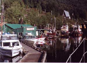
|
Had a few showers during the afternoon but then the clouds went away and we had a beautiful evening. We walked the half mile back across a little hill to the Kingfisher Lodge where we had a superb dinner. Been quite a while since we've had a chance for dinner out.
The kids showed up earlier than I had expected. They were shooting for the 10:30 out of Twassen but got there just in time for the 8:00 o'clock. Got here about 5:30. We unloaded them, had dinner, then took a walk through our little town. Couldn't have asked for a nicer day.
10:15 Got a bite with the hook on the second try at Ehatisaht. Until a few years ago there was a beautiful totem here but it was removed and taken to the museum in Victoria for preservation. As part of the deal, a replica was carved and placed in the old site. The next winter, so we're told, the wind blew it over. Taking this as a bad omen, the Ehatisaht band had it cut up and burned. We found the place where it stood in the middle of an overgrown graveyard. The remains of a small white picket fence which surrounded it are all that are left. This was a great place for a village. It has a good salmon stream flowing into the inlet, easy access to the sea, and a great view. We managed to dig a few clams on the beach even though there was only a five foot low tide today. Also found a couple of oyster, our first on this trip.
11:45 On our way again. Ran out almost to the entrance of Eliza Inlet and started trolling for salmon. John was using the downrigger at 100 feet, Nan the Deep Six diver. John picked up one almost immediately, a nice little Spring. He then caught two more off Double Island. There were several other boats fishing there. Nan let out two hundred turns with the diver, which I think would put her about sixty feet down, and picked up a Silver. She got one more on but lost it.
15:00 Decided to call it a day on fishing and head for home. We'd trolled across the inlet to Rosa Island and I figured we'd stay in Nuchatlitz for the evening so we went in the back way. It's a little spooky because the charts show so many rocks and the books make it sound almost impossible, but it's really a pretty easy entrance. We had a few anxious moments when we couldn't find a second buoy which all the charts called for, but relaxed when it finally appeared from behind a little islet.
15:30 Anchored in the big central bay at Nuchatlitz. This is sure a pretty place. We're almost on the ocean; but, completely surrounded by rocks, reefs, and islands, no swell gets into here. There are several residents here - a pretty little float house tucked in one tiny cove and a number of pretty well built houses scattered around the shoreline. It's sure not crowded though. We saw one black bear walking along the shore while we were cleaning our fish, and another later while taking a dinghy tour of the bay. We steamed the clams and baked two of the fish for dinner. Couldn't finish but one of them. John put out the crab ring and managed to pull up six or seven keepers during the evening. Then we toured the bay while watching a spectacular sunset, just enough clouds to paint the sky some gorgeous colors. Blue sky, sunshine, clams, oysters, salmon, crab, two bears, and now a super sunset, what a day!
12:55 Back on the boat, hook up, we're ready to go find a halibut. Picked our way out through the complicated channel with a little more confidence this time. Even though it was close to low tide we had a minimum of eighteen feet in the shallowest spot. Outside the sea was flat calm with only the northwest swell making waves reflecting off the rocks and reefs. We ran out past the whistle buoy until we got to 160 feet of water then shut down and dropped three lines to the bottom: one with bait, one with a white hoochie on it, and one jigging. Bah! In an hour the only action we got was on the one with the bait which twice managed to attract a dogfish as soon as Nan got it to the bottom. She gave up on bait and joined John who was jigging.
14:45 Gave up on halibut and tried trolling for salmon as we headed in toward Nuchatlitz Inlet. No luck there either although John did manage to bring in a nice Black Sea Bass near the Nuchatlitz Reef.
16:00 Anchored in Mary Basin, a large bay tucked deep in the inlet and surrounded by forested hills some of which have been logged off recently. Not as pretty as where we were last night but very well protected from any weather. It was cloudy this afternoon, although warm, and the weatherman says another front is approaching. Pigged out on John's crab for dinner. He has been the meat getter for the past couple of days.
09:00 Not today. Got out as far as South Reef but it was obvious from the wind blowing white caps on the water there inside the point that the outside seas would be rough and uncomfortable. So ... on with the old 180 degree turn.
09:30 Back at anchor, this time in a little different spot. None of our books mention it but on the chart the bay just to the south of Lord Island looked a little smaller and more interesting than Mary Basin itself. There's a seal rock in the entrance where we saw seals basking on the way in yesterday. They weren't there this morning but the anchorage turned out to be just what I'd hoped. We parked in front of what looked to be a good claming beach in 35 feet of water with lots of swinging room.
Got out the rain gear ... it was still pouring down ... and all climbed in the ding to go sightseeing. Because I figured we should be at about peak tidal flow we went first to the narrows leading into what is called the Inner Basin. We'd been told there would be a tidal falls there. It was farther than I'd thought, more than a mile in pouring rain, and when we got there the "falls" were almost slack. Either I figured wrong on the tide or the falls only work on spring tides. We went through far enough to look down the long basin then turned around and shot the rapids coming out.
Well, so much for that adventure. On to the next. At the east end of Mary Basin where the drying flat is a river comes in. We'd been told there was a falls there. Alright, let's go see. Hey, that's better! After picking our way through the very shallow channel the river has dug in the flat we came around a corner to find a really nice falls. It's thirty or forty feet high, a hundred feet wide and, especially this morning, had a lot of water flowing over it. We nosed right up to the pool at its foot to admire it. (Again I wonder what makes falls so interesting to people.)
By the time we got back to the boat the rain had eased and become showers. Lois and I sat back and relaxed while Nan and John went over to check out the beach for clams. Boy, did they ever find some. They came back about an hour later with three gallons of the largest, best looking steamers I've ever seen. They found them fairly deep in shell sand and had to do most of the digging under water (The tide today wasn't very low). Dinner tonight!
The rain had stopped now, and the wind had died, so it was time for another adventure ... the sea caves. Lois declined this one ... she doesn't like caves ... so the three of us headed off across the inlet for Benson Point where the book said they were. Well, again we were a little disappointed by the caves. Not what I'd call real caves, they are more crevices in the rock into which the sea can roll. That was okay though, we made a surf landing on one pretty little sand beach where we found bear tracks; and on another long sand beach there were tracks made by a big cat as it loped along the shore. There were four distinct long clawed prints spaced eighteen inches to two feet apart, then a six to eight foot space, then another series of four prints. The trail led for a quarter of a mile along the beach before turning up into the forest. Another set of tracks in the sand looked like a big dog's, probably a wolf out here in the wilderness. The biggest mammal we actually saw was a mouse that scurried off into the brush.
Pigged out on clams for dinner. We'll make another stab at getting to Nooka Sound in the morning.
07:50 Ferrer Point and it's a go. Big swells from the northwest, some chop from the south, but no wind and with the flopper-stoppers in it's not an uncomfortable ride.
10:05 When I come up from my ten o'clock engine room check I find us heading out to sea. George has quit steering. He acts like he'd been turned off but the breaker is on and everything else is working properly. Nothing to do but steer manually until we get into port. Nan was feeling just a slight bit queezy so I put her to work on that task. You don't realize how much work an autopilot saves until it quits.
10:45 The Baho Reef buoy. One of our books tells the story of the KING DAVID, a ship that went down on this reef in 1905. This buoy, three miles off shore, marks the outer limit of the reef. Now we can turn and head for the entrance to Nooka Sound. There's a constant drizzle coming down but still no wind and the ride has been an easy one.
12:00 Anchored in Bligh Cove, a small pocket at the end of a narrow three mile long inlet in the center of Bligh Island. The weatherman is still insisting that storm force winds are coming with the next front but we won't feel them in here. We had a lunch of crab, hauled in the flopper- stoppers, then Nan and I went to work on George. I got out the manual and started working the trouble-shooting logic diagram from start to end. Everything checked out okay. The 24 volt power, 8 volt power, and 4 volt power were all just as the book said they should be. We got down to the point where the diagram called for a faulty drive motor and I was about to give up. There's not much you can do to fix an electric motor in the field. In disgust, I gave the danged thing a whack with my hand and it started to run. Seems alright now but who knows when it will quit again. I hate it when things do that.
Work done, drizzle stopped for a while, we decided to go exploring. The little beach near our boat didn't look very promising but when we got to it we found a treasury of oysters. Took us about ten minutes to fill a five gallon pail with the little jewels. We seem to have gotten beyond the northerly oyster limit line. We gave a few to a fisherman anchored in the outer bay, brought the rest home, and shucked a bunch of them. Later Lois, Nan, and John went back to the beach and picked two more pails full while I cranked up the barbecue. We had barbecued oysters for dinner and have lots left to fry and stew. We're doing alright on sea food.
09:10 Hook up and we're off. Had to wash it down again. Most of the anchorages we've been in here on the west coast have mud bottoms, great holding but very messy. Ran down the Ewin Inlet channel and around the corner to Resolution Cove, the place where Captain Cook first arrived in British Columbia. There's not much to see there now. It's just a nice open cove which would be easy for a ship to sail in and out of. It provides pretty good protection from the swell although it's open to the east. There is a flag pole and a couple of plaques commemorating Cook's stay high on top of a shoreline rock. We dropped the hook on a rocky bottom and Nan, John, and I put on our rain gear and took the ding to get a closer look. Nan climbed the rock and took a picture of the plaques and that was it.
10:30 On our way again. Ran the three miles across the entrance to Nooka Sound to Friendly Cove, another of the famous spots of Northwest history. It was here that Vancouver and Quadra reached agreement on the relationship of Spain and England here in the northwest. We anchored in the center of the cove, donned our rain gear again, and the three of us went ashore while Lois tended the boat. We were greeted by a smiling Indian lady, Terry Williams whom we'd read about in Douglass' book, and her pretty, black eyed grandaughter. She welcomed us, collected a five dollar landing fee which pays for portable toilets and cleanup after visitors, and told us we were welcome to go anywhere except inside the graveyard fence. She said she was surprised to see us this late in the year but that it had been a busy summer for them. At one time they had seventeen boats anchored in the harbor. We walked out to the long pebble beach on the seaward side of the peninsula ... great view from there, toured the church with the stained glass windows and Nooka carvings, walked out the rock breakwater and climbed up to the island lighthouse and signed the guestbook there. It's sure quiet here now. The only residents are Terry and her family and the lighthouse keepers whom we never saw. One fishing boat is anchored in the cove but we never saw anybody on board.
13:00 Back on the boat, hook up again, we're going fishing. Didn't do bad. John caught another nice little Spring almost immediately and that was the end of our salmon, but between them they caught four rockfish including one very nice sized Bocaccio.
15:15 Gave up fishing and ran for home. Tonight it was a place that Douglass calls Bodega Cove. It's actually a wide spot in a very narrow channel running behind Bodega Island. Got there a little after four. Nan and John went to work cleaning fish and scrubbing clams, getting ready for leaving tomorrow. We put a big bag of clams and all the fish in the freezer. The oysters will keep nicely alive if they water them down occasionally. Had steamed clams and oyster stew for dinner. Hard to beat that. It's sure pretty in here despite the rain, with the clouds hanging over the treetops and drifting down the channel. Nice place to spend a last evening. John put down the crab ring and pulled up several keepers.
| 09:00 Off and running. Decided that if the Uchuck III can make it through Princessa Channel, we ought to be able to, so I put Nan and John out on the bows and poked through at idle speed. No problem, we never had less than twenty feet and they never saw a rock. The books make it sound like you are risking life and limb if you go that way without "local knowledge", but there's a red channel marker on one side and a green light on the other. The run up Tahsis Inlet was spectacular this morning. The fog kept drifting in and out across the water and mountains which form the inlet while the sun shone brightly on the jagged peaks of the range behind Tahsis. Nan was busy with her camera and John kept saying, "Nan! Take that picture." The ten miles went almost too fast. | 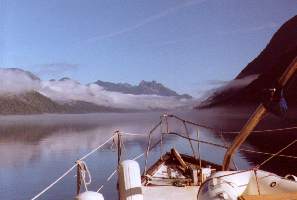
|
11:00 Tied to the float in the Westview Marina. Nan ran Lois over to the grocery store while John and I packed up the fish. Then we sat on the deck and had a lunch of crab and beer before they left. Sent them off with a cooler full of fish and clams plus a big bag of oysters.
Spent the rest of the day cleaning up and getting organized for more cruising. Alison, the lady in the marina office (Ramona was the one last week), had her brother David who works on one of the little tugs here run Lois over to the laundromat so she could catch up on the wash. I changed Gimmy's oil, banged on George again (He quit steering again as we were coming up the inlet. He may be about to quit for good), and checked our batteries. There's another big ship loading lumber here now, the SAGA CREST from Oslo, so it's a bit noisy but interesting. And the smell from the mill of new sawn lumber is really great. Alison dropped by to get a look at the boat and later David brought his two kids to do the same. In the evening we had another visitor, Clarence Hager, a man who owns one of the places at Nuchatlitz and knows Phil and Mary. He came aboard and we chatted for quite a while. Then he went back to where he is staying and brought us a fillet of halibut. We've sure had a friendly reception here at the Westview Marina. Don't remember any place where we've been treated so well.
09:15 Out into Eliza Passage. No fog here. Everything north seems to be clear although there are still clouds and fog on the Hesquiat Peninsula. The shoreline to the north of Hesquiat is strewn with rocks so we ran about two miles off shore. The swell wasn't big but it was almost on our beam so I dropped in one flopper-stopper. That steadied things down.
11:30 Estevan Point light. All sign of fog gone now as we make our turn and head almost due east. Riding down the face of the swells with a light breeze on our tail, we've put the last of the west coast terrors behind us.
13:15 Hot Springs Cove. Well, we've been told it has been pretty commercialized but I still wasn't quite prepared for the sight of so many people swarming over the rocks around the springs. There must have been thirty of them on this bright and sunny Saturday afternoon; and little boats zooming everywhere; and airplanes landing and taking off. We tied to one of the five mooring buoys and sat back to watch the action. There's a big houseboat tied to the government wharf which the book says is a bed and breakfast. Six or eight fast looking skiffs were also on the float. Across the bay there is an Indian village of forty or fifty houses, two more floats, and what looks to be a small hotel. During the afternoon skiffs, presumably from Tofino, kept coming and going carrying people both ways. Later the fishing boats came in. Four tied to the government float, three more on the mooring buoys with us, and a couple went over to the village floats. We decided that the time to visit the springs, if at all, would be early morning while the rest of the world is sleeping.
Ate the last of our clams for dinner and Lois baked the halibut that Clarence had given us. It was awful! He told us it was fresh frozen from only a few days ago but I think he must have picked up the wrong package. The first clue was that the plastic bag it was in had holes in it, as if it had been bounced around a long time. And the fish was oily and dark, something fresh halibut is NOT. Guess this just isn't our year to have halibut, even with a little help from our friends.
The walk was worth the effort anyway. It's through a magical old growth forest with giant ferns and huge fallen trees. The boardwalk builders used a lot of imagination in the way they routed the walk, sometimes cutting away only part of a fallen log to make a moss covered tunnel instead of just a path. The boardwalk itself is something special. Made with hand split cedar planks three to four inches thick and four to twenty-four inches wide, the names of hundreds of boats, groups, and individuals have been carved. The earliest date we saw was 1972 although our books say the boardwalk has been in existance for 60 years. The walk is very sturdy and well maintained but the old boards have been kept when new poles were placed under it. They are thick enough to last for many years.
10:20 Back at the boat, showered, and ready to go on to new adventures. Ran out to the entrance buoy where the chart shows a nice, flat, sand bottom about a hundred feet deep. The swell was very low and slow so we decided to give a halibut one more chance to come aboard. Lois and I jigged for fifteen minutes (our limit if we don't have somebody like Bob or Chuck pushing us) without any action so gave it up.
11:00 Onward! Up Sydney Inlet to a place Watmough's book calls Coyote Cove and Douglass' Bottleneck Cove. Doesn't matter what you call it, it's a tiny piece of paradise. We picked our way between big boulders guarding the narrow entrance and anchored in the center of a cove surrounded by old growth forest. We had a bite of lunch then went for a tour by dinghy. There are several small streams coming into the cove and, although it was high tide, we could see oysters strewn on the bottom along the shores. There's almost no sign of anyone ever having been here. In our tour we saw only one cut tree and a place where someone had built a small fire on a grassy spot on the shore. Clam and oyster shells are scattered along the shore but they appear to be the leavings of birds and animals. The fog was later in burning off today but by noon it was thinning out and the sun breaking through. Beautiful day!
Back at the boat, I went to work on George again ... he never did work yesterday. This time I took his motor apart. I couldn't see anything definitely wrong with it but when I loosened the two screws holding it together it started running beautifully. Almost seems like it was binding up in some way. Anyway, when I put it back together and tightened them again it still ran nicely. We'll see if he works tomorrow. It was a beautiful afternoon with just a light breeze, just the kind I've been waiting for to work on our intermittent anemometer; so I climbed the mast and found the guilty connection buried under a gob of silicone sealant. Put it back together with a small wire nut and now we'll be able to know how fast the wind is blowing.
I got out the barbecue and we had barbecued steaks for dinner, the first non-seafood dinner we've had in quite a while. Afterwards, we ran over to a small beach near the boat and, in five minutes without Lois even getting out of the boat, I picked up a bucket full of oysters. What's more, a probe in the sand with an oar turned up three clams. We didn't have our scratcher with us so I'll go back in the morning and get a bucket of those tasty little guys. When we got back to the boat the barbecue was still hot so we had a couple of oysters for desert.
We were sitting drinking in the silence after the sun went down over the mountain to the west when a bright glow appeared on the mountain top to the east. Fog was just starting to form along the ridge and I at first thought it was some kind of reflection from the sun; but then Lois, who had a slightly different view of it, said, "It's the moon!" Sure enough, the almost full disk soon climbed over the ridge and beamed down on us. I can't remember ever seeing a moonrise so bright. Great way to end another great day.
09:20 Hauled anchor and poked our way out of this pretty pocket. It's got to be on our list of favorite anchorages. Ran back down to Shelter Inlet and turned left. I was sort of planning on wandering on around Flores Island back to the ocean where we might pick up a salmon. We're in pretty good shape for seafood but fresh out of fish. We passed three or four anchorages along Shelter Inlet but none the book made sound very interesting. Several had fish farms in them. George seems to be feeling pretty good after the attention I gave him yesterday. He's steering beautifully.
10:30 Approaching Obstruction Island and Hayden Passage where the current is supposed to run at four knots the thought occured to me that we might find a salmon there. Okay, slow down, drop in the lines. Let's see what we can do. The tide was with us as we entered the passage and we were drifting along at about 2.5 knots when Lois hooked a nice little Spring. Neat! We have dinner. She'd hardly gotten back in the water when she hook another, this one much bigger and a real fighter. She got it up to the boat though, and almost into the net before it made a run under the boat and was gone. Boy, was she mad. That was just the start of our fun though. As we came to the riffles on the far side of the narrows we both started hooking fish.
11:45 Quit fishing with nine salmon on board, one more than our limit. We'd intended to stop at our limit of eight but when I started cleaning them there were nine in the bag. We'd been having so much fun we'd lost count. That was the second first of the day ... Not being much of a dedicated fisherman, I don't believe I've ever limited before on any kind of fish, let alone doing it in an hour and a quarter.
13:00 Parked in Bacchante Bay at the far end of Shelter Inlet, I went to work cleaning fish while Lois packaged. They weren't big. The largest was about ten pounds, the others ranged between four and eight. We kept the four smallest whole for baking and filleted the others. Got a good start at filling the freezer again.
Once we got our work done and the decks cleaned up we relaxed to enjoy the warm afternoon. The sun had come up this morning bright and shiny with no fog or cloud to get in its way and now it was almost hot. We put on our summer clothes and went for a ride up the river in Stormy. What Bottleneck Cove has in intimacy, this place has in grandeur. It is also completely landlock but quite a bit larger. And here the granite walls rise almost vertically to over 3000 feet in all directions. The effect is spectacular. We motored up the river about a half mile to where there's a white water drop over a big pile of rounded rocks into a deep pool. Then we shut the motor down and just drifted. Moss covered old growth forest surrounds the pool with thousands of ferns hanging out over the water. A cool spot for a warm day with the mountains towering above. There are trails leading from the pool off into the forest. Not people type trails, they look more like some a bear might make. We drifted and paddled from the pool down the river until the breeze started pushing us back upstream.
At low tide there were hundreds of birds on the drying flat, and one black bear came out, poked around for a while, then wandered back into the woods. We baked one of our little salmon for dinner and ate half of it. Decided to save the oysters and clams for later. We're so far down in the hole the sun went down early but twilight lasted for a long time and it stayed warm. Full moon tonight and it was bright in the sky. Lovely place, lovely day.
10:00 Fishing.
10:10 Lois pulls in the first fish, and nice little Spring. That's a good start. In the next couple of hours we put four salmon and four rockfish in the box, a catch that at any other time we'd have counted as very good. After yesterday, however, it was a little disappointing. Funny how quickly good luck can spoil you.
12:00 Gave it up and went to cleaning fish. Put ten to fifteen pounds more of pure meat in the freezer. Poor thing is having a hard time catching up. To keep it going we ran slowly again into the little Indian village of Ahousat.
13:30 Tied to the end of the fuel dock in front of the Ahousat store. It was closed while the storekeeper sorted the mail; so, while waiting, we made a lunch out of the crab we caught in Bottleneck Cove. Several of the locals came by and welcomed us to their village. Very friendly bunch. The store is a very relaxed kind of place. Unlike most of the village general stores we've been in, this one isn't very organized. It's sort of a jumble with groceries, hardware, clothing, magazines, produce all mixed. Several people were sitting in straight chairs near the checkout counter while the storekeeper sorted their mail out of a big pile. He looks like his store, a friendly, disorganized guy. He's not a native but he wore a T-shirt with an Indian design stretched over hs pot belly. He didn't have much in the way of produce but we didn't need much.
14:40 On our way again. Contrary to what the book says, we saw no sign of power on the Ahousat dock so we decided to go find a quiet spot to anchor.
15:30 Found it at Westpine Cove, not quite as scenic as the last couple of anchorages we been in but still a very pretty place, and very well protected from any weather. Not that that's an issue today, there's no wind, the sun's bright in the sky, and the temperature is pushing eighty again. I shucked a dozen oysters and we had steamed clams and fried oysters for dinner. I stuffed myself until it hurt. Did you ever get to the point where you thought that it just couldn't get any better? I think we're there. If it looks like good traveling in the morning we may just skip Tofino and shoot on down to Ucluelet. I think we're both ready to start heading for home.
08:20 At our turn point out past Blunden Island and the Plover reef. It's getting pretty lumpy. There's no wind and hasn't been for several days so I think it's probably caused by the ebbing tide out of the sound. There's a troller fishing out here and to avoid him I make my turn a little too early. Dumped one of Lois' plants over. Okay, drop in a flopper-stopper. I was right about the lump. If we'd have kept going another ten minutes, we'd not have needed it.
08:45 Lennard Island light. Running with the swell now, smooth as can be, with the sawtooth mountains of Vancouver Island on our port beam and the pacific Pacific to starboard. I hadn't realized how high the mountains of Meares Island are, two grand hills rising to almost 3000 feet. One is called Lone Cone. Spectacular country.
10:25 A C-130, all painted in Canadian Coast Guard orange and red, has been circling over our heads and now drops a smoke bomb a mile off our beam in Wickaninnish Bay. We've been monitoring coast guard traffic on channel 22A so know that it's just an exercise. A few minutes later they drop another. They seem to be trying to put the smokes near a couple of yellow buoys in the water. We're the only boat in miles.
12:00 Off Point Amphitrite Point and Ucluelet we decide it's just too pretty a day to spend the afternoon in a busy, dirty harbor and city so we keep going around the rocks and into island filled Barkley Sound. The FRANCIS BARKLEY was on her way into Ucluelet as we passed.
12:45 Made a pass by the Sea Lion rookery rock off Wouver Island. Yep, the noisy critters are still there, a hundred or more of them. We came in from up wind so we didn't have benefit of the stench. Didn't see any big bulls which are usually there.
13:30 Anchored in Effingham Bay. Pulled in our poles, got down the ding, fixed ourselves a couple of tall Collins on this warm afternoon, and took a tour of the island. The southeast shore of Effingham has some of the most interesting scenery anywhere. There are caves and arches, rocky cliffs and sandy beaches, kelp forests, and rock gardens aplenty. We went ashore at the site of the Indian village and walked along the huge clamshell midden which must have taken centuries to build. It's covered now with a thick carpet of soft moss which would put anyone's lawn to shame. It was dry today but green and cushiony to our feet. We poked our nose into the big sea cave west of the village which we had walked to back in '86 and rode the swell under one of the big stone arches. On the southwest side of the island several small runabouts were fishing. Must be a good spot. I think we fished there one day with Sis and Paul.
Had barbecued clams and oysters for dinner, then sat and watched a beautiful sunset across the rocks and islands of the sound. Going down earlier these days. Just realized it was the last day of summer ... or the first day of fall. Whichever, it was great!
09:15 Hook up, we're heading for the big city on another glorious morning.
10:00 Parked on the 53 step float at Ucluelet. This is where we first saw old SEA RAVEN on another sunny day just about nine years ago. At that time she was the SEABORN. She's sure been a good ship. We climbed the steps and walked to town past people out working in their gardens. Went to the Co-op for our groceries. First really good market we've been in for a long time. Their produce is as good and fresh as that in any supermarket, and their shelves are well stocked with everything. Bought all we could carry, then stopped by the liquor store and got a bag of wine. Wow, what a load! We made it back though and we're now well stocked for a last week of cruising.
11:45 Headed out again. Passed four of the Canadian Princess party boats coming in from their half day fishing tours. They seem to be doing a pretty good fall business. Decided to do a little fishing ourselves so dropped in the lines and trolled along the George Fraser Islands and down the Felice Channel. I caught one little Spring and won the pot. First time I've caught more than Lois in quite a while.
14:20 On our way up the Loudoun Channel I changed to each aft tank for twenty minutes. By my calculations that should leave only about 25 gallons in each of them. All the rest of the fuel is in the forward tanks where I can measure it. We've never been this low on fuel but we've still got close to 300 gallons, enough to run more than 500 miles.
15:20 Anchored between Mence and Brabant Islands where Bob picked up the big plank we've been carrying around for the past eight years. It's a neat little nook with lots of oysters in a bed near an ancient fishtrap. First place we ever went where we had trouble walking without stepping on an oyster. We got down the ding and went for a little tour. Stopped on Hand Island. We've never anchored there. It's a popular kayaking destination. Has water, pit toilets, and "primitive" campsites. Nobody there when we stopped but later several kayaks passed SEA RAVEN on their way there.
Baked my little fish for dinner on the barbecue. Again, half was plenty for the two of us. These little guys are sure good eating.
11:30 The fog lifting a little. Time to go. Got to give Lois a chance to win her 30 cents back. Followed some kayakers out the channel and started fishing in about 100 feet of water. No luck here, so moved on to Swale Rock. Picked up a little guy just before we got to the rock, then followed a small sportfisher though the fog around it. Fished for another hour with no action before deciding to give it up. Started to pull in the lines and discovered I had one on. Ain't that somethin'? Two days in a row I beat the champion fisherlady. She's still way ahead on total weight caught however.
13:30 Headed across the Imperial Eagle Channel for Dodger Channel, sort of a jumping off place for the Strait of Juan de Fuca. It's still thick with fog out here and the weatherman says it's going to stay around for a while, so we've decided to push on for the San Juans in the morning. Tain't much fun cruising in the fog. Watched one blip on the radar keep a collision course with us for almost half an hour before a big seiner appeared as a ghostly shadow out of the white blanket ahead. We did a three-sixty and passed behind him. There were a couple of other blips on the screen but they never got close enough to see. It's the same way out in the strait. Tofino Traffic was having a busy time keeping vessels sorted out in the traffic lanes.
14:30 Into Dodger Channel. Fog lifted just enough for us to sneak in and get anchored before it closed in again. Too bad. This would be a very interesting anchorage if we could see it. The surf is crashing on the rocks just in front of us but there's almost no swell in here tucked between three small islands and countless rocks and reefs. We can hear the Cape Beale fog horn sounding loud and clear every thirty seconds. Dodger is more an anchorage than a channel. The south entrance is less than two fathoms deep so it's used only by small vessels. Bamfield is just a couple of miles away across the Trevor Channel but this afternoon not a boat came by. After dark the moon came out and cast an eerie light over the boat. The fog evidently isn't awfully deep but it's sure thick.
Finished yesterday's salmon for dinner and watched a video tape of an old Garrison Keiler radio show which Shirley had recorded for us five years ago. In the morning we'll check in with Traffic and join the others in the big strait.
07:45 Off Cape Beale and still riding nicely without the flopper-stoppers. I check in with Tofino Traffic, telling them we'll be taking a direct course to Neah Bay and asking that we be kept informed of traffic. The controller says there's none at this time.
08:45 Off Pachina Point we pick up our first target on the radar five miles off in the murk and watch for the next half hour as he slides past headed somewhere north.
10:30 Nearing the traffic lanes now. Traffic calls and says there's a tanker, the VOLGA, outbound at 12 miles and the ARONA, a freighter, inbound at 9. We've got both on radar. He also asks that we watch for signs of an oil spill. They've had a report of one and the SHEARWATER, a cleanup ship, is out looking for it.
11:00 Looks like we're all going to meet at Buoy "J", a Racon buoy marking the entrance to Juan de Fuca. Well, not quite. Traffic asks the VOLGA to keep going west rather than turning in front of we inbound ships and it looks like we are going to cross ARONA's bow before she gets to the buoy with about a half mile to spare. We heard the ARONA's fog horn but never saw either ship.
12:00 Tofino Traffic checks us out as we cross Longitude 124o 40'. We're now in Seattle Traffic's domain but we're out of the separation lanes and almost home so don't check in with them.
12:30 Anchored in Neah Bay. Fog cleared just as we came in and it's a very pretty day. This is a big, shallow bay behind a long breakwater which joins Waadah Island to the mainland. Our book says it's a port of entry but we could see no sign of Customs as we came in. We could check in by telephone but we haven't paid our 1994 fee yet and I wasn't sure what complications that might cause on a Saturday afternoon. So we cheated. I popped Stormy in the water, ran over to the general store, bought a bag of charcoal which we need in case Gennie won't start, hauled anchor again, and left.
15:00 On our way again. Looked like we might have a nice run on into the Straight but no luck there. As soon as we got outside the fog rolled in again. On the radio we hear some poor guy on a small boat called BROADCASTER who was out fishing with his two kids when the fog rolled in. He's lost and just about got run down by a ship. Sounds scared to death. One idiot on the SOBRE LAS OLAS confuses the guy even more by assuming he left from Neah Bay and advising him to steer south. He finally wises up enough to call Coast Guard but he's too close to the mountains on the north shore for them to hear him. I got on the radio and relayed for him. Turns out he had left from Port Renfrew, had no chart, and had failed to keep track of which way he'd gone when the fog caught him. While we were talking with Vancouver Coast Guard another boat, the ELK HUNTER, which was near Port Renfrew came on and together we figured out where he must be. Got him headed north toward shore where the fog cleared enough for ELK HUNTER to find him and point him toward home. Well, about a half hour later BROADCASTER called again. The fog had rolled in and he was lost again. He could hear the foghorn at Point Sand Juan but all he could see was rocks, rocks, rocks! I told him that those were the ones marking the entrance and that if he kept following them around he'd be in the port. Not long after that he called and said that he was at the launch ramp. Bet he and the kids had quite a story to tell Mama when they got home.
17:00 Anchored at Sekiu. Looks like there's a marina here where we could have tied up but since we haven't checked in yet I decided to hand on the hook. Fog cleared again in the evening. I got out the barbecue again and we had another meal of steamed clams and barbecued oysters. Wow, we're eating good! While we were eating a couple of ultralights were circling over our heads. Must have been from the strip on top of the hill.
11:30 Race Rocks. Radar returns everywhere, Sunday morning fisherpeople not about to be kept from their enjoyment by a little fog. And now the ships are turning across our track too, into the big bay off Victoria where the pilot station is. Fortunately, the fog started to lift just about the time we sighted the first sportfisher dead ahead. In a few more minutes we were in the bright sunshine and Lois was changing to her shorts. We ran that way for a couple of hours, almost across Haro Strait, before it closed in again. On the way a large group of Dall's Porpoise joined us and stayed for several minutes, welcoming us home.
14:30 San Juan Channel in the fog, and again lots of dummies running around out here fishing. We'd been thinking of spending the night in Mackay Harbor; but we've never been in there and I'm a bit leary of entering a strange harbor in the soup, so we dived into the channel. As we did a power cruiser called the FORTH OF JULY came out of the fog on our starboard bow, cut across in front of us, slowed down, then cut back across. I called him on the radio and asked his intentions. He said he was going through the channel to Friday Harbor but then he kept on swinging back anf forth, speeding up and slowing down in front of us. I slowed down and stayed behind him, afraid to pass. He didn't sound drunk on the radio but he sure acted like he was.
13:15 Anchored in Griffin Bay in bright sunshine. Griffin is a big bay north of Cattle Point on the south tip of San Juan Island. A long finger of fog was coming through the channel but all the rest of the bay and island were in the clear. Had a restful afternoon watching the traffic come through the pass. Lots of it on this Sunday afternoon, both on the water and on the airways. Channel 16 was never quiet with dozens of boats running around wanting to chit-chat with one another. There's a great difference in the radio cultures of Canada and the U.S. In BC they seldom use call signs even though the rules say they should; and the Channel 16 calling is usually very brief, like, "SEA RAVEN, MARY J here. Go channel 72." Here every call is something like, "SEA RAVEN, SEA RAVEN, SEA RAVEN. This is the MARY J, Whiskey November Kilo, Five Seven Niner. SEA RAVEN, do you copy?" And then on a day like today they all call at once, never listening to see if the channel is busy. Channel 16 is the calling and distress frequency which you are supposed to monitor but on days like today I get disgusted and shut it off.
Fried oysters again for dinner. Gennie agreed to start for one more time. I'm sure Lois is getting pretty tired of seafood but I'm sure not. We've still got a bucket of clams and two of oysters on the aft deck. Maybe we'll share with the neighbors when we get in tomorrow.
08:45 Hauled up and headed for town. Dropped in the fishing lines on the way, soaked them for a while (no bites), then pulled them in slowly while wiping the jellyfish remains off. We've had jellyfish almost everywhere we've been for the past month and the lines were pretty cruddy.
09:30 Tied to the breakwater at Friday Harbor. Walked up to Customs and checked in (Entry number 441665B - They'll bill us for the $25.00 fee), checked in with the crew at the port office and called Lois on the radio to tell her she was cleared to leave, then we both started walking for the house. Got out Roche Harbor road to the trailer court before Hugh Watt came by and gave us a ride up the hill. All okay at the house, and the Mustang started with just a little Hot Start in the carb. Took it down to the airport where it was the same story on the van. The four months rest doesn't seem to have done them any harm. Went to the Driftwood for a sandwich and ran into Virgil Hennen. He got back from fishing last week. Said he had a good year with a great catch of Coho. He told us he paid, but expects to get back, the $1500 fee the Canadians collected once the politicians get though posturing.
Took two dock carts of food and other stuff off the boat. Found when we emptied the freezer that we had as much fish as we sent home with each of our summer visitors. It just about filled the small freezer we have at the house. Gave a bucket of oysters to Virgil and Judy and we still have one bucket for ourselves plus a bunch of clams. But, for a change in diet, we went to the Electric Company for a pizza and beer dinner. The oysters and clams will keep another day.