06:20 At the south channel can buoy we turn right to a heading of 42o which will take us directly to the White Rocks Light at the north end of Banks Island. That's the closest spot on the mainland and, since we've three weeks to get to Port Hardy, we're in no hurry. The bottom, down over a hundred feet in the channel, immediately jumped up to 24 feet. We were two thirds of the way across Hecate before it got 100 feet deep again. She's a wide and shallow strait.
08:30 I noticed that the bilge pump came on a couple of times in the past hour so I went down to check. Thinking it was the shaft packing gland, I tightened the nuts on it a bit but water still kept coming in faster than it should. Looking closer, I found that water was coming from behind the flange of the fitting. It's held in place by four 5/8" stainless bolts which go through the bulkhead, presumably to a backing plate on the other side. I tightened the nuts on the bolts as best I could with a small cresent wrench and the flow slowed down a little. Have to attend to that when we get in. Out here's no place to do the job.
It was an easy crossing. The wind stayed quiet until about 9:30 and even then was well within the 10-15 knot prediction. About 10:00 I dropped in one stabilizer foil when the waves started to rock us a bit. They were almost on our beam so we did no pitching.
12:30 As we pass Bonilla Island and head for home a big Sea Lion rises out of the now deep water, stares at us for a few moments, and then sinks slowly. Wind picking up now. Glad we're almost there.
13:10 Tied to one of the six buoys in Larson Harbor. This is a neat place. We stayed here in 1987 the night before we jumped over to the Charlottes. The Pilot says "local knowledge is necessary" but I'm not sure why. The entrance is straight and just as the chart shows. At this time the shallower areas are well marked with heavy kelp and we never had less than 20 feet as we came in. Maybe later in the summer when the kelp covers the entire passage it would be harder to find. With the rain and the wind we just stayed on board. When the engine room cooled and I went down to check my leaking packing gland fitting the leak had stopped. I tightened the four bolts with a ratchet anyway. One was quite loose. It's possible that when the engine mount dropped and the fitting overheated the sealing material on the bulkhead was damaged. Well, the problem seems to have gone away but I'll keep an eye on it for a while.
Later another boat, the FAIR HEIDE, came in and picked up one of the other buoys. Nice looking sailing vessel rigged with flopper-stoppers and with a commercial fishing number on the side. They cleaned a halibut on the deck and later went over to one of the small islands that protect this harbour and brought back two kayaks which had been tucked back in the brush.
Jake invited us along but Lois was having problems with her back this morning so we declined. Instead, we took a dinghy tour of the harbour and surrounding islands. Larson Harbour is formed by a mini-archipelago of hundreds of islands, islets, and rocks interspaced with waterways. Even near low tide we were able to find our way betwixt and between dozens of them on paths choked with kelp all the way to the entrance to Griffith Harbor, a similar anchorage a few miles to the south. From the chart, we could have kept going for another ten miles without getting out into the strait. Lois was having real back trouble though, so we came back and I went clamming instead. Couldn't find any Littlenecks but got a dozen Butterclams in a square foot space. I cleaned a few and ate them as a test for PSP. No ill effects. We can have a chowder of the rest. While Lois was resting I dropped a Buzz Bomb over the side and hardly got it to the bottom before there was a nice rockfish on it. Caught four more and had them for dinner. Lot's of fish around here. If Lois is feeling better tomorrow we'll go out and try for salmon or halibut.
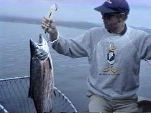
08:05 As we crossed the 100 foot line I came back to idle and went back to put out the lines. I got Lois' line in, the one with the Deep Six diver on it, and was just starting to attach my line to the downrigger when: "Zzzzinnnnnng!" her line went crazy. I got the net while she played the fish and brought in a beautiful eight pound Coho, perfect eating size.
08:30 Running again. Weatherman's still insisting that a storm is brewing so we want to find a good hidy-hole early today. Our prime candidates are Colby Cove about ten miles down Principe Channel and Patterson inlet on the west shore of big Pitt Island. Both look like potential hurricane holes. There's a good stiff 15-20 breeze up the channel but only enough wave to splash our windows not bounce us.
10:25 Colby, a tiny pocket on the east side of Banks Island. The entrance is very narrow but never less than 30 feet deep and it's easy to follow to the hundred yard wide basin. The only rocks are well marked with kelp. We were close to low tide and inside we could see nothing but rock walls topped with forest. It would be a hidy-hole alright, but not a very interesting place to spend an afternoon. We decide to keep going.
12:15 At the entrance to Patterson. It's also a narrow crack in the side of a mountain but much larger than Colby, about two miles long with two arms in each of which the Pilot says you can anchor. We chose the south.
12:45 Anchored in front of what appears to be a new logging camp. There's a big barge here with several portable buildings and a big crane on it, a long string of boom logs tied to the barge, and a helicopter sitting on the hill above. We got settled just as our long awaited front hit and the rain started so we didn't go ashore but soon the helicopter took off and in two trips brought five men back from wherever they'd been working. No sign of any logs being dumped yet but it looks like there will be soon. We spent the afternoon on the boat fixing things and watching a couple of movies while the rain poured down. Fresh salmon for dinner and enough in the freezer for three more meals; hard to beat that. Hopefully, tomorrow will be nicer and we can go ashore for a visit with the loggers and a walk to Devon Lake which the chart shows just a half mile from the head of the inlet.
10:30 Back on the boat, anchor up, we're going fishing. Started just outside the Patterson entrance. We didn't have the instant success that we had yesterday but we managed to do all right; got two Coho, one small one and one about the same size as the one yesterday. Got both of them just around the point on the south side of Minktrap Inlet, and both with the downrigger 100 feet down. Surprizing, Coho usually aren't that deep. I was looking for the odd Spring. While we were fishing we also poked our nose into a couple of other anchorages. The north arm of Patterson looks like a very comfortable anchorage, and it's not as deep and steep as the south. Moolock Cove in Minktrap is quite a bit larger and deeper. It didn't look as inviting.
14:30 Back in the south arm of Patterson. I cleaned the fish and took the larger over to the logging barge for the crew. After we cleaned up both Lois and I went back and met Karen, the cook, and the rest of the crew. Karen said she's been cooking for mining crews for eight years and this is her first season in a logging camp. She thought she'd like to be near the sea. Nice lady, she insisted that we stay for "supper". She had cooked our salmon plus pork chops, french fries, green veggies, salad, cream puffs, and chocolate cake. The crew eats pretty good. Interesting talking to the crew. One of them is a flyer. He owns a Yak-18 and has been to Friday Harbor on the way to the air show at Arlington. He also flew a Supercub to Mexico, landing at many of the places where we've been. None of this crew fit the Paul Bunyon image. None are very big guys. I'd never guess them as loggers on the street. Fun evening.
After we got back to the boat the wind picked up and the rain started again. It blew and rained hard most of the night. Lois got me out of bed once to drop some more chain when she found we were hanging in 97 feet of water. Hope I can get the pick up in the morning.
11:00 Slowed down to fish off Fleishman Point when we saw another boat there and lots of reflections on the sounder. Ten minutes later Lois pulled in a nice Coho.
11:30 Fishing again in Otter Channel at the mouth of Sharp Bay on the north end of Trutch Island, this time hoping for a halibut. No luck on that but I did bring up a nice big Pacific Cod. Just as we were taking care of it the water started erupting off to the west of us. Next thing we knew we were in the middle of the most active bunch of White Sided Dolphins I've ever seen. There were about thirty of them and were they ever having fun. They went roaring across our stern, leaping high out of the water as they raced each other in no particular direction. Then they were all around us going every whichy-way. I think I got some good videos. We had been drift fishing and when we now cranked up the dolphins followed us. For at least fifteen minutes and all the way to Squally Sound the whole pod stayed right with us at eight knots; and for over an hour there were two or three splashing at our side. They would disappear for a few minutes then be there again. I have no way of knowing whether they were part of the same group or whether there are just a lot of them in Squally Sound.
13:30 Lois was napping as we ran down Squally when two small land birds which looked like sparrows to me came flying along side the boat. One of them landed on the deck locker and stood there for a few moments looking miserable, all huddled up, feathers ruffling in the wind. Then it flew down into the ding, working its way all the way to the front where it could get out of the wind and rain under the big tube of the inflatable. It stayed there for twenty minutes or more, flying up just once when its buddy reappeared but then coming back. Finally it seemed to be recovered and flew off in the direction of land a couple of miles away.
14:00 Rounding the corner into Whale Channel we start to see boats everywhere, more boats than we've seen in weeks except in harbours, all fishing along the shore. And lots of radio chatter. In this country we gotten used to hearing almost nothing on the radio except Prince Rupert Coast Guard. We're heading for the only decent anchorage in the area and I guess that it won't be as deserted as most of the ones we've been in recently. We may have company tonight.
14:30 Yep, as we turn into Barnard Harbour we see big lodge at the head and the Coast Guard ship, GORDON REID, anchored inside. But where are all the little boats coming from? Kitimat is the closest city and it's at least fifty miles away. In Cameron Cove off the main bay we anchored between a small sailboat and a power cruiser called NORUSH. Cleaned our fish and settled down for an afternoon in the rain. Before morning we were joined by fifteen more boats of various sizes. No problem, there's lots of room. Tomorrow we'd stop by the lodge and see if we can figure out where they are all coming from.
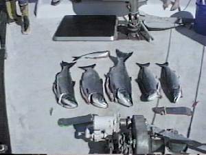
08:30 Out of the bay and around the corner, we started trolling in the Ashdown Island Channel. Didn't take long to get our fish. I hadn't had the lines in five minutes when the first hit and Lois helped me land a nice eight pounder. Ten minutes later the same thing, except this time the fish struck then charged the boat. I've never had one do that to me before. It was right on the surface coming straight at me while my line hung limp; then it went the other way just as fast. Fortunately, I had the drag very loose and it just peeled off some line. When we got it aboard we found that it had been hooked though the eye. Maybe that's what made it so frantic. While we were putting it in the box I noticed Lois' pole jumping. Yep, she had one on. It had taken the hoochie even though we were in neutral and just drifting. Three fish in less than twenty minutes. Wish Bob and Kris had been here.
Deciding that was enough salmon for a while, we headed out into Campania Sound looking for a likely halibut spot. No luck there. We stopped twice, once in Campania and again in Loredo Channel, and managed to hook nothing but a little dogfish shark. Oh well, you can't win them all.
15:00 Anchored in Meyer's Passage which divides Swindle Island from the big Princess Royal Island. Last year we went out Lorado Sound and around the south end of Price Island to cross Milbank Sound. This time I decided to take the inside route through the narrows. The Pilot says "local knowledge is essential", so we parked and I took the ding through first. Looks pretty easy; the channel is narrow but fairly straight and the rocks are marked with plenty of kelp. There's one navigation buoy by the only dangerous rocks. High tide is at 20:05 this evening so we waited for a while to be sure of having a good ten feet under us.
17:30 Hauled anchor and headed in. No sweat in the narrows; we never had less than twenty feet of water. By following the path between the kelp I even managed to miss the spot shown on the chart as 1/2 fathom.
18:15 Anchored in the Jorgensen Anchorage next to a little sailboat called LAURAL which had been in Cameron Cove with us last night. They are also from Friday Harbor and we found that I had met the lady, Bobbie, in the dentist's office there. I think the skipper's name is Glen.
09:00 Klemtu. Parked on the dock by the fuel float and went hunting for a post office. I had some bill payments which needed to be sent so we walked the long boardwalk to the Canada Post office an the other end of the bay in the rain only to find that it was closed. Wouldn't you know, it's another Canadian holiday, BC Day this time. They seem to have as many holidays as the Mexicans. Oh well, the walk did us good and a nice old Indian named Louis Hopkins agreed to post our letters tomorrow. There are phones in Klemtu so we checked in with Allyn at work. They are planning on driving to Port Hardy, getting in late on the 14th.
10:15 On our way again, this time in search of a halibut. There's a 25 fathom bank out off the south end of Swindle Island that looks promising on the chart.
11:30 McGregor Bank. Baited with a couple of the squid Bob bought for us and dropped them to the bottom in 150 feet of water. Nice and flat out here even though we are at the top of the notoriouus Milbank Sound. Rain still coming down but we're in our foul weather gear and quite comfortable. No fish though, at least on the bottom. We never got a bite. While we were there three big cattle boats went by, the GOLDEN PRINCESS and two others. Must be the height of the cruise ship season.
12:30 Finished our lunch and still not a nibble but there are Coho jumping around us so we pulled in, changed gear, and started trolling. Didn't take long. Ten minutes later I had one on the line. Got it in and then hooked a little shaker through the eye so badly that we decided to keep it. About then Lois pole began to jump and she pulled in another nice Coho. That was enough. We headed for home, wherever that might be. We'd never been through Oscar Passage so that's where I headed. Charley says there's a nice anchorage on the east end of it.
15:25 Anchored in the east cove north of Arthur Island. It's a pretty place and pretty well protected from all directions. Don't need much of that today. It's still flat calm with the rain coming straight down. I cleaned our fish and we settled down for a quiet evening in the rain. One of these days the sun will shine again.
10:00 Through the Percival Narrows a half hour before turn to ebb. The Pilot says that it runs at five knots at times but both times we've been through we could hardly detect a current. Not like some of the narrows we've been in which are filled with swirls even at slack. Out on the Milbank Sound I was looking for a spot where we might find a halibut. I didn't plug it into the GPS so missed the first one I'd picked on the chart. There was a skiff fishing off the lighthouse on Ivory Island but that looked to me like rockfish country so we crossed Seaforth Channel to a bank on the south side.
10:45 I'd just dropped the lines to the bottom in 150 feet of water when something started nibbling. First I brought up a fair sized rockfish, then Lois pulled in a ten pound Yelloweye, then I another rockfish. Bah! Well, it's dinner but I sure wish we could find a 'but.
11:15 Decided to run on into Bella Bella and fire off a log update to the family. I printed it out on the way. Lots of traffic in the Seaforth Channel today ... trollers, seiners, cruise ships, sailboats, powerboats, etc.
13:00 Tied to the fuel dock at Bella Bella. Bought gas for the ding from the same Indian guy who I had the spat with last year. He was nice enough today but he's hyper. He works fast and hard at everything. I think last year I just punched his button at the wrong time. We took our mail up to the post office in the Band store and bought a few groceries there. Bella Bella was busy today, lots of people coming and going.
14:00 On our way again, down the Lama Passage looking for a home.
15:00 Fancy Cove, one of our favorite anchorages. It's properly named, a tiny arm off the channel with several mini-arms off it and a couple of islets decorating its shores. The bottom in the center is almost flat at 40 feet. We met a boat called the SEA BEAR coming out as we went in. Looked like a fishing vessel converted to a cruiser. Inside we had the whole place to ourselves. It was a beautiful summer afternoon, warm and sunny in the cove. I cleaned our fish, washed down the deck, then we sat and enjoyed the good weather. Hope it lasts for a while.
09:40 Namu. This old cannery facility is still in some kind of operation, being run now by the "Namu Harbor Resort" whatever that is. The store is open and has a few groceries and a pretty good supply of commercial fishing and boat gear. Some of the maintenance shops seem to be operating but the rest of the big buildings and the Namu Cafe are closed. A few of the old company houses appear well kept and lived in. We tied to the float below the store where there is a hose with what the lady in the store said is good water, so we filled our tank. They also have a big incinerator so we could get rid of our trash.
10:30 On our way again. Ran down Fitz Hugh Sound with the fog drifting in and out but by the time we got to Addenbroke Island it had lifted completely. Really a very nice day.
13:05 Whales off Addenbroke Point, a cow and calf, first we've seen for a while. We were planning on stopping for the night in the Schooner Retreat on Pemrose Island and I hadn't able to find a likely looking halibut spot on the chart so we decided to troll our way across Darby Channel. Took almost ten minutes for Lois to hook a Coho. Then I got one and lost one when it jumped and threw the hook. There were a bunch of skiffs from the Rivers Inlet fishing lodges fishing around the Rouse Reef off the end of Pemrose. We skirted them, trolling along and enjoying the sun on the way into the anchorage. Almost to the entrance, we went back to pull in the lines. I got mine in and went to help Lois who was having trouble tripping her diver, or so she thought. I gave the pole a big jerk and couldn't seem to trip it either, Then I realized she had another fish on. I gave the pole back to her and she pulled in a nice Coho. It didn't have much fight. Must have been on the hook for quite a while.
15:30 Anchored behind Fury Island in a neat little pocket almost totally landlocked at low tide. At high tide there are a couple of low sand and gravel bars which cover opening the bay to the sea, but the bottom is sand and good holding. It's a great place to wait for good weather. You can see what's happening outside. One other boat in here, the PENQUIN. The skipper came by in his skiff and saw me butchering our fish. He said he hadn't had any success but when he saw ours he was going out to try again. Later two more boats came in, the RAVEN and PS, but there's plenty of room. I cleaned and froze our fish and Lois fixed country ribs for dinner. Nice change from our steady fish diet. Had a little thunder storm come through in the evening. That's something we haven't seen for a long time.
09:20 Back on the boat, breakfast over, Stormy stowed on the deck, and we're on our way again. There's a light rain coming down which doesn't disturb dozen's of fishermen out around the west end of Pemrose. Our freezer's so full we decided to forgo fishing today, unless we find a good halibut spot that is. Ran across the mouth of Rivers Inlet and around the Dugout Rocks where the commercial fishing fleet was working, and past False Egg Island into Smith Sound. I wanted to see Milbrook Cove, one of the stopping places which Charley mentions which we've never visited.
10:30 Milbrook would be okay I guess if you were getting beat up and wanted to stop, but it's not nearly as nice a place as Fury Island. It's another of the many coves carved out of solid rock with little place to go ashore and no beach. We swung by the entrance and then headed back out. As we left a beatup boat came in towing a log. Looked like an Indian crew. They may have a camp somewhere inside. We weren't in any hurry, and the weather was turning nice, so we decided to take a little better look at Smith Sound. As we ran east there were several cruising boats fishing in the inlet. None of the books we have even mentions Smith Sound but obviously some people know about it.
12:15 Takush Harbour, a bay about five miles in on the south side of Smith. The chart shows an Indian Village site here. There's an official Canadian vessel anchored in the center of the bay, the ROBSON REEF, probably a fisheries patrol vessel although I couldn'd see the fisheries emblem. We found the village site but there were no buildings or poles and it looked so overgrown with brush that we didn't go ashore.
14:20 Back in Queen Charlotte Sound rounding Cape Caution on a glassy smooth sea, a whale surfaces a hundred feet off our port bow. The water is only about fifty feet deep here but the sounder shows lots of feed. this big Humpback is getting lunch.
15:20 Through the "Outer Narrows" and into Slingsby Channel about twenty minutes after high slack. Not much current now, although the Pilot says it can run as high as eight knots.
16:12 Dropped our hook on a rocky bottom in Treadwell Bay. This is the parking lot for the infamous Nakwakto Rapids which the book says run as fast as any in the world, 16 knots on a peak Spring tide. The Canadian Sailing Directions (Which I call the Pilot) has some spectacular aerial photos of it in full flow. We'll go through tomorrow but make sure we do it at slack tide. One other boat in here tonight, the DREA, a small home made looking cruiser. Must also be planning to transit the rapids tomorrow.
09:30 Time to go. Came around the corner just in time to see a tug towing a loaded barge pass Buttress Island on the way to the narrows. Our reading of slack time must be okay, and if that big guy can make it there has to be plenty of water.
9:55 We coast through behind the barge. No sweat. And Charley is all wrong with his statement that you "can only pass the narrows at high slack". We never had less than 50 feet of water at low slack.
Inside, we turned left and headed northwest toward Balize Inlet. About a mile from the entrance we were surprised to find a pretty little floating fishing lodge, five or six newly built little cabins on log floats tucked in a small cove on the north side of the inlet. Seymour Inlet Lodge the sign said. Several small boats flying dive flags were in front of it.
Other than for that the inlet is typical of this area, steep rock walls topped with cedar forest line almost every inch of it. We ran about five miles up Belize then turned north toward Mereworth Sound as far as Village Cove. That's a pretty little pocket behind some islets which would be a good anchorage. A small river runs into the inlet there. From there we ran west up Strachen Bay where we found another float house at the mouth of the creek flowing out of Pack Lake. I was hoping to be able to get into the lake so we dropped our hook and I took the ding ashore. No luck. The stream to the lake is short but too shallow for the motor and too fast moving to row. And I could find no trail or way to get through the heavy brush on foot. No one was at the float house but it's obvously occupied by someone connected with logging. One of the two small boats moored there is a small tow boat.
We ate lunch, then pulled the pick and headed back toward the narrows. Talked to a cruiser going up the inlet on the way back, the SANDMAN from Seattle. The skipper said they'd been down Seymore and it was much the same as we'd seen north. There's just not much of great interest in these inlets unless you're a logger. Got back about an hour before high slack so stopped and tried to talk to someone at the Seymore Inlet Lodge but the bottom came up so fast that we couldn't get close. Tried trolling across the narrows. No way! Too much swirl and trash, so we headed through about a half hour early.
15:15 Through the worst of the flow. Amazing what a change a few minutes can make. We ran past Butress Island and poked our nose in an anchorage that the Pilot says is good. We didn't like it ... too confined and too much current for comfort ... so we went back to Treadwell. DREA still here, and a sailboat now, parked very close to the shore. We dropped our hook where we'd been before and settled down for a rainy evening. Weatherman says this is going to break but no sign so far.
09:45 Around Roy Island and into Allison Harbour, a long narrow bay where there used to be a fair sized community. No sign of it now. As we came in we got a call from WESTERN REACHES, a boat we'd seen in Klemtu. They were anchored at the head of the bay. After we got settled we went over and visited with them. Larry and Linda Reeve and daughter Kate from Veral Beach, Florida. They had the boat, a 34 foot cabin cruiser, shipped out here from Florida and outfitted her in Seattle. Got as far north as Wrangle before getting disgusted with the weather and turned around. They plan another month in BC before putting the boat up for sale and flying back to Florida.
After our visit we toured the harbour a bit in the ding. Not a lot to see here. Someone has put a lot of effort into building a neat cabin on top of a tiny islet near where the old cannery was but now the windows are all boarded up and it doesn't look like it's been used for a while.
Larry and Linda were planning to move over to Blunden Harbour in the afternoon so we decided to go too and were hauling anchor when there wsas a, Bang! and the windless quit. Same problem that we'd had up in the Spicer islands, the bolt holding the retaining place on the high speed gear shaft had come loose and let the shaft slip out of the bushing. I know now what's happening. When I replaced the hydraulic hose that we blew last winter I reversed the direction of the drive, thinking that it would wear more evenly. Unfortunately, it's now turning in a direction to loosen the bolt. What's more, this time when I tried to get it back together I dropped the Woodruff key down into the windless and I don't have another. I made one abortive attempt to do a Mickey Mouse fix by using a couple of lock washers cut in half as a key, but they too fell down in the housing. Nothing to do but pull the windless off and tear it apart. That took an hour and a half or so but we got it done, and this time I put a lock washer on the offending bolt. When we get back to Friday Harbor I'll reverse the hoses again and turn the shaft the other way.
15:00 Windless working, anchor up, and we're on our way. We'd planned on fishing on the way to Blunden but instead we took a couple of packages of salmon out of the freezer. Larry is going to try for some crab for dinner.
17:10 Anchored in Blunden in front of the old village site. Lois and Linda want to look for trading beads tomorrow. Had the Reaches over for a dinner of barbecued salmon and visited until ten o'clock. Nice family.
|
|
10:00 Hook up, gear ready, we ran just outside the harbor and joined several commercial fishing boats trolling close by. We'd hardly gotten the gear in the water before we had one on the line. I pulled in a nice ten pound Coho. We caught five more and lost three plus one flasher and two hoochies before we quit. I let Larry bring in all the rest. |
| He was like a kid on his first fishing trip, elated when he brought one in, so disappointed when one got off the hook. Back in the harbor we had a show and tell session with the ladies, cleaned and filleted the fish ... our freezer's solid full now and Larry and Linda have lots to smoke ... then went over to their boat for another dinner of salmon. Fun day. |
|
11:00 Just outside the entrance to Hardy Bay the curtain lifted, not suddenly like it sometimes does with a coastal fog bank, but slowly drifting away letting the world appear again. And what's more, Homer had reserved a spot on the city dock for us, the only one not filled with fishing boats. They are rafted up to five deep here. Someone must have just moved out. It was a little tight but a friendly young man from Poland helped us squeeze in and tie up.
Spent the rest of the day on the dock. Walked to town, had lunch at the Hardy Rock Cafe, then walked over to to the inner harbor marina to check things out there and stretch our legs. They have power and water on the docks there but it's a long walk to town or to any grocery store. There's water on the Sea Gate Wharf where we are but not on the floats. Called Allyn, Nan, and Dad. Allyn says they'll be here Saturday night and will be leaving Thursday morning. That won't give us time to take them with us to Coal Harbour so we'll just fool around here. Also called Howard and Judy Nettleton. They are thinking about coming the week of the 28th. Nan and John will be coming the week of September 12th. Lots of good company for the rest of our trip.
Had our clams for dinner. That was a real treat. We've missed the little steamers. Late in the evening Hugh and Sally Watt stopped by in their ding. They have been here "on the boom" for three days. Want to move over to where we are tomorrow.
14:15 Cranked up and moved around to the Chevron fuel dock in the Quarterdeck Marina. Bought two pails and a case of four liter jugs of Delo 100. Had to take SAE #30 weight. They had no #40 but that should be okay for a couple of changes. Filled our water tank and we were ready to go. In the meantime Hugh and Sally were at the ESSO dock filling their boat, the GULF ISLAND, with gasoline. Hugh says it gets about one mile to the gallon. Glad we run on diesel.
15:00 On our way. It's not far to Hurst Island, only ten or twelve miles from Port Hardy. Lots of happy fishermen out here today. It's cloudy with almost no wind so it's easy fishing, and the Coho are biting everywhere.
16:30 Anchored in Harlequin. Hugh was sure right. I'd have never tried to bring SEA RAVEN in here without a guide. The entrance is filled with rocks and islets you have to wind your way around and there are no navigation aids. Hugh and Sally talked me in on the radio, decribing the landmarks as we came in trailing close behind them. It went something like this:
Follow the shoreline around into the outer bay until you are about centered in it, then head across toward the north shore lining up a large tree fallen in the water with a white rock outcropping in the bay behind you. There is a drying reef on your starboard and a sunken rock on your port. As you approach the north shore you will see another small bay off on the south shore. When lined up with that bay turn directly toward it. Again, there are sunken rocks on both sides. When almost to the bay turn right again staying about mid-channel as you enter the inner bay. Anchor off the large midden on the north shore.
Charley never reported less than 19 feet of water which, translates to 23 feet actually in the channel. At a zero tide that would be eight feet, not a lot of clearance for our 7.5 foot draft but then we wouldn't ever be coming in on a zero tide. It's worth the effort, a beautiful little cove tucked way up into the heart of the island with the biggest clam midden I've ever seen on the north shore. We came in and parked in about 24 feet of water, but we were close to a 15 foot high tide, so on the low of 2.0 in the morning we won't have a lot of water under our keel. It's a mud bottom though, and quite flat. Settled down and then went over to GULF ISLAND for a drink with the Watts. While we were there two other boats found there way into our bay, the RAVEN and the PUFFIN. We talked to the skipper of the RAVEN. They've been diving off Hunt Rock. Said it's the best he's ever seen. He said he'd never been in here before either and just felt his way in. He's got more guts than I have. Tomorrow we'll go take a look at the midden.
Hugh and Sally said that the last time they were here they had seen people on the beach at the head of the inlet and assumed that there must be a trail across the island to the little resort at God's Pocket. So we all went to see if we could find it. When an hour of crashing through the woods didn't turn it up we tried another tack: we got in their Boston Whaler and ran around the island to God's Pocket and asked the lady there how to find the trail. Then we hiked to Harlequin and back from there. The trail is about a half mile long as the crow flies, and well marked. A big Doberman dog from the resort showed us the way. The reason we couldn't find it at this end is that it starts straight up an almost cliff. You have to pull yourself up with a rope someone has tied to a tree. We thought it would have gone up a draw. Anyway we got our exercise for today. When we got home the Watts came over for drinks and steamed clams. We ate the last of them. Guess we'll have to go back to Blunden for some more.
13:00 Charley's saying, "Ten!"(Feet under our hull), so we should have plenty of water in the channel as I haul the anchor up with A HUGE ball of kelp hanging on it. Had to use the machete to cut it off. No sweat in the channel; after several times through it in the ding I hit the center better than Hugh did when he came in. Fog still hanging outside as we head for Hardy Bay but lifting rapidly now.
14:30 At the Sea Gate wharf the floats are full so we decide to take another tip from the Watts and go look at the log boom in the inner basin. Breeze blowing now so it was a bit of a trick getting tied up but we managed it. Very comfortable here, no wakes, and except for the log movers which quit about five o'clock and the float planes which are fun to watch, there isn't much noise. We ran over to the float plane terminal and used the phone there to make an appointment for Lois to get her hair done. On the way a salmon almost landed in her lap. The pinks are jumping all over the bay and this one came down only a couple of feet from the ding. Later a big sailboat called the KOLEA came in to the bay. The skipper seemed confused about where to go so we offered to let them raft with us. Two old guys from Capistrano Beach in California and a younger gal from Pender Harbour. Said they had sailed seventeen hours yesterday around Price Island and then traveled all day today in the fog coming around Cape Caution. They were pretty pooped. Disappeared below as soon as they got tied up and that's the last we heard from them.